I Love Xinjiang — A Seven-Day Journey Through China's Northwest Frontier
As the saying goes, "You don't know how vast China is until you've been to Xinjiang; you don't know how beautiful China is until you've been to Xinjiang." Xinjiang is world-famous as the land of fruits, song and dance, and as the home of gold and jade. Its vast territory covers one-sixth of China's total land area. Urumqi, the capital of Xinjiang, sits at the geographic center of Asia.
July 28 – August 3, 2011 — I was in China's northwest, on the Silk Road, at the heart of Asia, in Urumqi!
Itinerary:
Day 1 Urumqi: International Grand Bazaar
Day 2 Turpan: Flaming Mountains – Grape Valley – Karez Wells
Day 3 Heavenly Lake – Karamay
Day 4 Devil's City – Five-Colored Beach
Day 5 Burqin – Kanas
Day 6 Baihaba Border – Kanas – Urumqi
Day 7 Urumqi – Shanghai
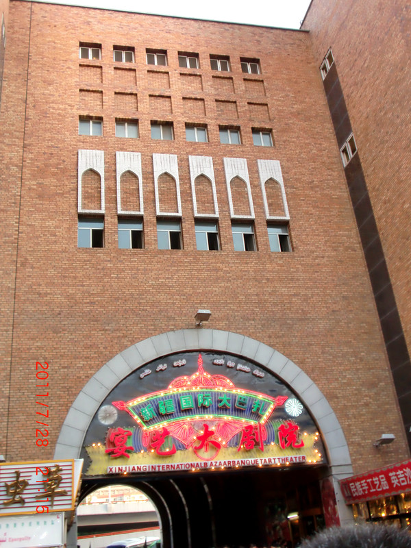
Day 1 Urumqi – Dinner at the International Grand Bazaar
Xinjiang runs two hours behind the rest of China. People here start work at 9:30 or 10, have lunch at 2 PM, and eat dinner at 8 PM. By the time we arrived, it was already past 9 PM Beijing time.
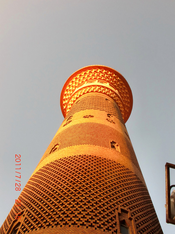
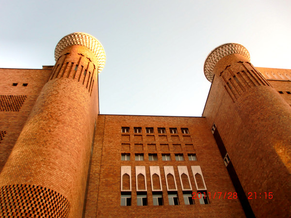
The Xinjiang International Grand Bazaar in Urumqi's Tianshan District is a must-visit for most travelers coming to the city. "Bazaar" simply means market. The architecture of the International Grand Bazaar has a distinctly Islamic style.
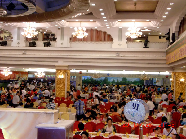
This is also where all kinds of Xinjiang cuisine come together. Here you can taste authentic grilled lamb skewers, roasted whole lamb, pilaf, laghman noodles, naren, horse sausage, blood sausage, mianfeizi, stir-fried rice noodles, and more. Let's dig into a feast while watching the performances!
Day 2 Turpan: Flaming Mountains – Grape Valley – Karez Wells
Xinjiang is enormous, and the distances between attractions are long. It often takes half a day by car to reach the next spot — the journey is tough.
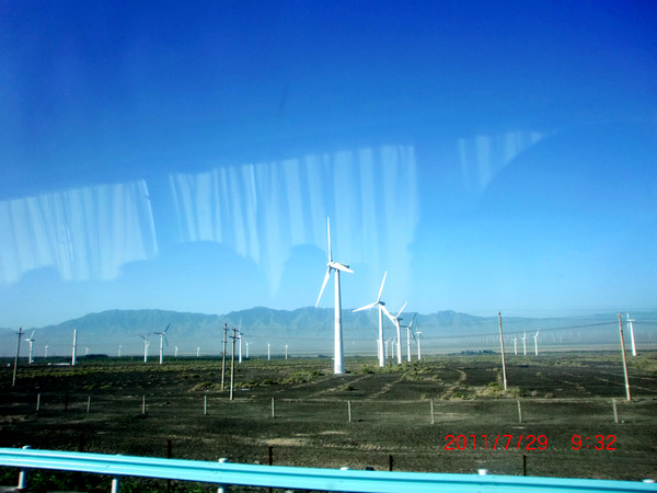
Along the way, we passed Asia's large wind power station — the Dabancheng Power Station.
1. Flaming Mountains
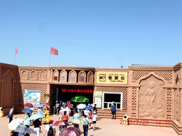
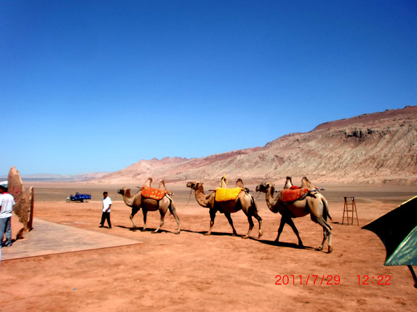
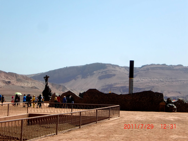
The Flaming Mountains scenic area sits in the middle of the Turpan Basin, featuring a landscape dominated by fiery red and brown sandstone formations. Historically, this was the site of the ancient Gaochang Kingdom, and it's also the Flaming Mountain from the novel Journey to the West, where Tang Monk and his disciples borrowed the Banana Fan to put out the great fire. It's an essential stop for anyone visiting Turpan.
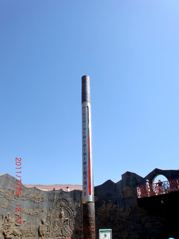
The ground temperature was 65°C — this place holds a Guinness World Record for surface temperature. A specialty here: eggs baked in the sand.
In the distance stands a statue of Sun Wukong — probably checking the thermometer.
2. Grape Valley
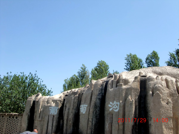
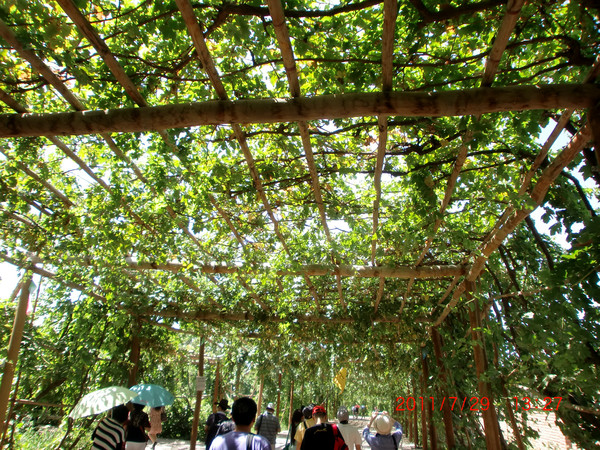
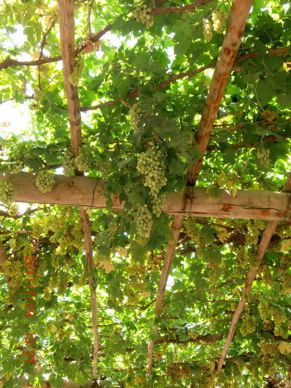
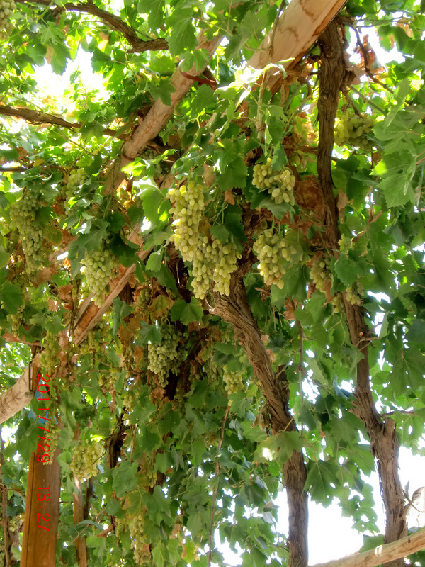
Located at the western end of the Flaming Mountains, Grape Valley is a nationally famous grape-producing region. The valley is lush and green, planted with nearly a hundred varieties of grapes including seedless white, mummy grapes, white jiaqian, red rose, and suosuo, forming a natural grape museum.
Grape Valley is one of the few cool oases in the scorching Turpan region. Walking in, it feels like entering a sweet homeland — everywhere you look, strings of green pearls hang from the vines.
3. Karez Wells: One of the three great ancient engineering projects of China, alongside the Great Wall and the Beijing-Hangzhou Grand Canal.
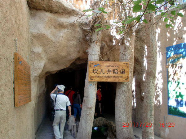
Across the vast Gobi oasis, you can see many raised mounds of earth arranged in orderly rows extending southward. These are the vertical shafts of the karez wells, with underground channels beneath them. The karez system consists of four parts: vertical shafts, underground channels, open channels, and reservoirs. It's an ancient hydraulic engineering feat that uses local geography, hydrogeology, and terrain to bring groundwater to the surface without any power source.
The karez wells are an underground irrigation system created by the ancient people of Xinjiang. Because the northwest is geologically dry with scarce water sources, this engineering feat became the source of life in the desert. Along with the Great Wall and the Beijing-Hangzhou Grand Canal, it's known as one of China's three great ancient projects. It was recorded as early as in the Records of the Grand Historian, where it was called "well canal." In Uyghur, it's called "kariz." It's a special irrigation system of desert regions, commonly found in the Turpan area of Xinjiang. The karez system consists of four parts: vertical shafts, underground channels, open channels, and reservoirs.
The instrument shop at the entrance.
4. Jiaohe Ancient City
Jiaohe Ancient City has a long history. It was once the capital of the Jushi Kingdom, one of the thirty-six kingdoms of the ancient Western Regions. The existing ruins are all architectural complexes from the Tang Dynasty, making it one of the largest and best-preserved earthen architectural sites in China.
Day 3 Tianshan Heavenly Lake
Passing through bustling shops.
Tianshan Heavenly Lake: In ancient mythology, this was the "Jade Pool" where the Queen Mother of the West held her grand peach banquet for the immortals. It's a national 5A-level scenic area.
Heavenly Lake boasts gorgeous natural scenery, encompassing alpine glaciers, wetland meadows, forest gorges, lakes and mountains, and Gobi desert. It forms a complete vertical spectrum of plant life, a rarity both in China and abroad. The cultural landscape, rooted in ancient Jade Pool mythology, religious traditions, and ethnic customs, adds a unique charm that makes this scenic area a precious cultural heritage site.
Overnight in Karamay.
At 10 PM, people were still playing badminton.
Day 4 Karamay "Devil's City" – Burqin "Five-Colored Beach"
After breakfast, we drove to the Urho Devil's City under Karamay's jurisdiction. Along the way, we passed large numbers of drilling rigs extracting oil (Karamay is China's famous oil city).
1. Devil's City: Located at the northwestern edge of the Junggar Basin in Xinjiang, in the Urho mining area along the lower reaches of the Jiamu River, 100 kilometers southwest of Karamay. Its unique wind-eroded landscape features bizarre shapes. The local Mongols call it "Sulumuhak." The Uyghurs call it "Shaitankerxi," meaning Devil's City.
The scenic area features typical yardang landforms — enormous stone pillars of various shapes standing side by side on the Gobi, some resembling animals, some resembling people, each with its own character, truly spectacular and majestic.
Urho Devil's City sits at a wind gap, also known as "Wind City," because strong winds often howl between the stone pillars, sounding like ghosts wailing and wolves howling — hence the name. Karamay Devil's City belongs to the yardang landform category. Over time, under nature's masterful hand, it has formed a dreamlike maze world.
Due to wind and rain erosion, the ground has formed gullies of varying depths. The exposed rock layers have been carved by fierce winds into strange shapes. On the rolling slopes, scattered stones of blood red, deep blue, pure white, and orange yellow look like jewels dropped by a sorceress, adding an even more mysterious quality.
Heading to Burqin.
Checked into Burqin Friendship Peak Hotel.
In the evening, we headed to the "Five-Colored Beach."
Golden sunflowers.
2. Five-Colored Beach
Five-Colored Beach is located in Burqin County, Altay Prefecture, at the northern tip of Xinjiang. It sits on the first and second terraces of the north bank of the Irtysh River — China's only river that flows into the Arctic Ocean — at an elevation of 480 meters. The beach is split by the river, with different scenery on the north and south banks. It's a national 4A-level scenic area. The landform is unique, a long-term dry zone belonging to the typical colored hills category.
Five-Colored Beach is also called Five-Colored Riverbank. Located in the Irtysh River basin, it was formed over time by wind erosion, water erosion, and leaching — a typical yardang landform. What makes it special is also its brilliant colors and varied shapes. After millions of years of wind and rain erosion and river scouring, vivid colors of red, green, purple, yellow, and brown appear on the nearly barren riverbank.
Nature's fantastic craftsmanship, the multicolored yardang landform, and China's only river flowing into the Arctic Ocean — the Irtysh — running right through it. The Five-Colored Beach has a unique terrain, a long-term dry zone with strong winds that have transformed the originally flat ground into steep ridges (platforms) and wide shallow gullies alternating with steep, precipitous hills. The Uyghurs call this "yardang," also known as "yar dan."
The dark figure on the left is someone admiring the view.
Waiting quietly for sunset.
Day 5 Kanas
Passed through Chonghur Township and got off to rest.
Passed through Aronggaiti Grassland, "the place bathed in sunlight" — a